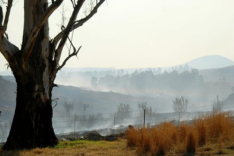
Winter in some parts of South Africa is a time of low (or no) rainfall and high fire danger. Sheldon Strydom studies the relationship between weather and fire, in particular how Berg winds, also known as mountain flow events, are linked to periods of enhanced fire danger. Mid-July is typically a high risk period. He shares what he has learnt during his research in the midlands of KwaZulu-Natal province in South Africa, close to the country’s largest mountain range, the Drakensberg.
What are Berg winds and how do they form?
It’s long been known that mountain winds (“foëhn winds”, “chinook winds” and the like) increase fire danger. There’s case study evidence from around the globe.
In South Africa, these mountain winds are known as Berg winds. They are generally experienced as warm and dry.
A mountain wind starts when a mass of air is forced to rise along a windward slope (the side of the mountain that wind is blowing towards). As the mass of air rises it cools. When it reaches the peak of the slope or mountain it descends on the leeward (sheltered) side. As it gets lower, the air gets warmer.
Berg winds commonly occur in South African winters when high atmospheric pressure systems are situated over the interior of the country and low pressure systems are situated off the coast. (Atmospheric pressure is the pressure of air over the land, and affects the movement of air.)
Usually, a coastal low pressure system happens a day or two before a cold front. The pressure gradient (difference in pressure that drives wind) between the interior high pressure cell and coastal low pressure cell results in air flowing towards the coast from the interior of the country, down the mountain escarpment. The air reaches coastal areas as a warm, dry wind.
Why study the relationship between Berg winds and fires?
Winds can spread fires in the landscape.
Our study, using data from four sites in the midlands of KwaZulu-Natal, quantified the effect of Berg winds on the microclimate (local weather conditions) and emphasised how these changes influence fire danger.
The sources of fires in South Africa, as elsewhere, vary. For example, wildfires can be started when prescribed burning, or the planned use of fire, becomes uncontrolled due to changes in weather conditions. Accidental fires and arson are the most common causes of wildfires. Research shows that wildfires and fire disasters are common in areas where prescribed burning is used.
prescribed burning, or the planned use of fire, is an important aspect of agricultural management. It promotes the dispersal and germination of seeds from a number of species and also removes ground litter. Prescribed burning is used to manage grasslands and has been linked to decreasing the number of disease-borne vectors such as ticks.
But if they get out of control, fires pose a threat to farmland and plantations.
It’s therefore vital to have weather forecasts and monitoring systems that warn of conditions conducive to the development and spread of fires.
Internationally, fire danger indices or meters are used to monitor conditions. In South Africa, the South African Weather Service and other interested and affected parties currently use the Lowveld fire danger index. The index is calculated using records of air temperature, relative humidity and wind speed and rainfall. These are measured once a day. Daily forecasts are available from the Weather Service and disseminated to local fire protection associations.
Much research in South Africa has focused on pyrogeography (understanding when and where fires occur) and fire ecology. Little research has been done to quantify the effects of Berg winds on fire danger using available historical hourly meteorological data.
The midlands of KwaZulu-Natal province serve as a perfect environment to study the effects of Berg winds on the microclimate and fire danger. The area is close to the Drakensberg mountains and experiences frequent fires. It’s also a largely agricultural area.
What did you discover?
The study developed a fuzzy logic system (a mathematical method for handling uncertainty) to identify periods of Berg wind conditions using historical hourly meteorological data in four sites.
We analysed variables like the air temperature, relative humidity, wind speed, and fire danger at different times of the day and night, before and during Berg winds.
The analysis revealed the significance of change experienced in the local weather conditions (within 2km) during periods of Berg winds, and how these changes influence fire danger.
It found that:
Berg winds were more common during daytime hours and affected the microclimate most during the day
during daytime Berg wind events, air temperatures rose by an average of 5.5°C; humidity fell by an average of 16%; and wind speed increased by an average of 5.2 metres per second
daytime Berg wind events significantly elevated fire danger
night-time Berg winds, while less common, did still result in significant change in the microclimate
at night, fire danger increases when a combination of variables change significantly.
The fuzzy logic system can be useful in two ways: to quantify the effects of Berg winds on the microclimate and to complement any fire danger monitoring system. It can measure conditions at a higher temporal resolution, such as every 10 minutes, or hour – making it more useful for monitoring near real-time changes in fire danger.
The system could be valuable for operational use by agencies like the KwaZulu-Natal Provincial Disaster Management Centre, and could be applied in other regions vulnerable to fire risk.
Sheldon Strydom receives funding from Rhodes University, and the National Research Foundation.
Michael John Savage has received funding from the NRF.
By Sheldon Strydom, Senior Lecturer & Head of Department, Department of Geography, Rhodes University And
Michael John Savage, Professor emeritus, Agrometeorology, University of KwaZulu-Natal


